High Water Marks

Graffiti is not a modern phenomenon—indeed, one need look no further than our wooden boardwalk by the Schuylkill River to see examples over 200 years old.
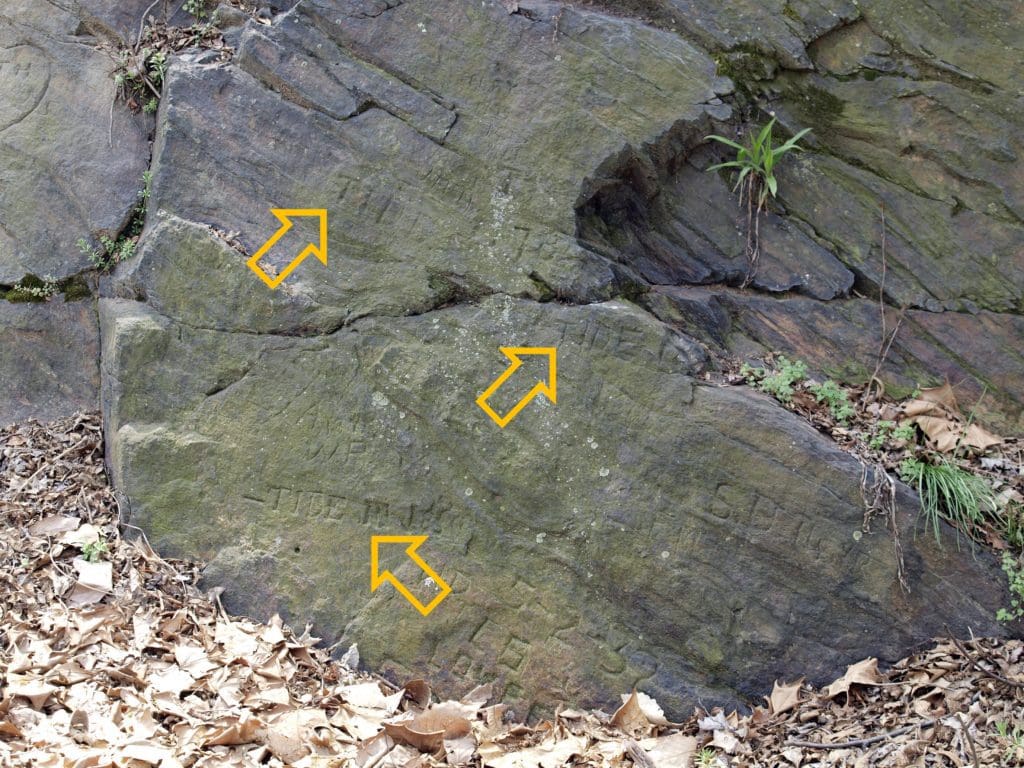
Observant visitors to Bartram’s Garden who meander down to the riverfront will notice a rock face etched with carvings. While most of the marks are modern, there are several historical etchings worth pointing out: closer to ground (above three feet above it) are several marks recording tidal high points of the Schuylkill River: “TIDE 1784,” “TIDE 17— [last 2 digits eroded away],” and “TIDE IN 1850.”
These markings (the author of which is unknown) were likely intended to identify exceptionally high tide levels, and they tell us (even today) that it takes an extraordinary amount of water to raise the lower Schuylkill level any degree. Most likely these floods were either in the spring-thaw period—perhaps March—or in late summer during tropical storms. Tropical storms seem more likely, as a tidal surge up the Delaware Bay will also raise the water level of the lower Schuylkill.
Says Bartram’s Garden curator Joel Fry: “I’ve never seen a storm here create flooding that reaches any of these marks, but within the last five years, there have been a couple of storms where the lower ground along the river did flood. The water was either just beneath the boardwalk area there, almost reaching the rock face, or one storm the water was actually just over the top of the boardwalk. Because of the great width of the lower Schuylkill valley, it takes a great deal of water to raise much of a flood—and most of South Philadelphia (which would flood almost entirely before the water got very high here) on the east bank is lower than our west bank.”


